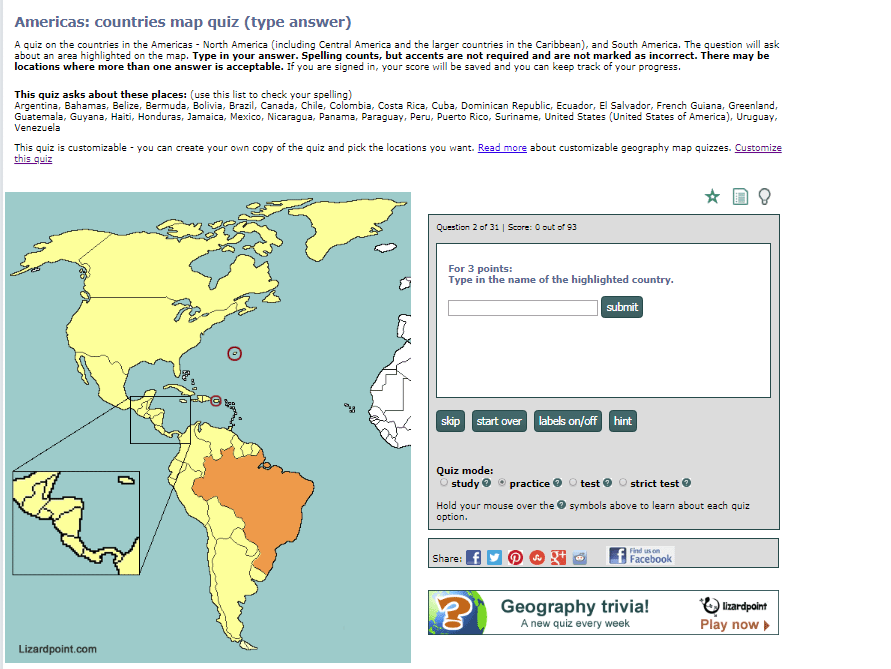
What's the opposite of clicking on a map to show where a country is? We'll show you the country on the map, and you type in its name.
This reverse activity will keep your brain fresh - you'll have to think in a different direction, plus you'll have to learn how to spell. It's funny the things you think you can spell until you actually have to do it!
Here's what it looks like:
Spelling counts. We can't check every possible name for a country, so for the most part, we are using the common short names used in English.
If you're in doubt as to what we'll accept for the answer, check the section near the top of the screen where it says: "This quiz asks about these places", followed by the list of names, in alphabetic order. This list to help you with your spelling will only be available in practice mode. In other test and strict test modes, you'll need to remember how to spell.
If we accept an alternative, it will be in parentheses - for example "Côte d'Ivoire (Ivory Coast)". Good news - you don't have to type the accents. If you choose to use accents, we ignore them, so a correct answer doesn't necessarily mean you got the accents correct.
Another thing you can do in practice mode is get a HINT. Just click on the Hint button to see the first letter of the country name... keep clicking to reveal more letters. For now, you can ask for as many hints as you need.
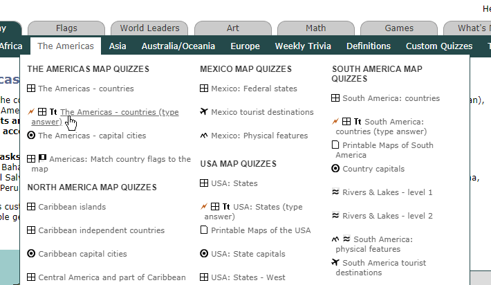
Where to find these quizzes:
We've just launched 9 of these quizzes. Look for the Tt symbol on the menu:
Also, all of these quizzes are customizable, meaning you can choose which questions to test yourself or your students on. Some are customizable by anyone with a free account, and some are customizable by premium members only.
The new quiz is customizable - so you can pick the questions, change the title and description, force it into a particular mode, such as strict test mode, etc.
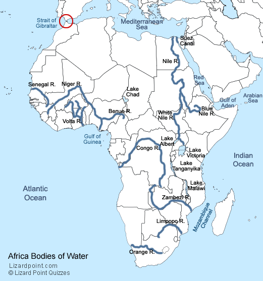
The old quiz asked about rivers and lakes. The new quiz adds in 8 more questions:
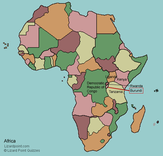
Burundi, a small nation in central east Africa, has declared a new capital city.
It was a promise made in March 2007, finally fulfilled. The Burundian government has officially declared the small town of Gitega to be its new capital city. The announcement was made over the Dec 22/23 2018 weekend, and Gitega became the capital on Dec 24.
How small is Gitega? The population of Bujumbura, the previous capital city (which will continue to be the country's economic centre), is approx. 331,700 (2018 figure). Gitega's population is 23,167 (2018 est.)
Location of Burundi in central east Africa is shown on this map:
For the next few months (maybe longer), the African capital cities quiz will ask you, "Where is Gitega (previously Bujumbura)?", so if you have memorized Bujumbura, you'll still be able to ace the quiz.
We've just launched a handful of new quizzes designed for Travel and Tourism students, but anyone can use them. The questions cover a variety of types of destinations: cities, popular sites, landmarks, national parks, resorts, beaches, natural wonders etc. Check the end of this post for a sample customization of a USA quiz that is more geography focused.
These quizzes require you to know the country, state or province where a destination is located. So, for example, in the USA tourism quiz, if you are asked "Where is the Empire State Building?", you would answer by clicking on the state of New York.
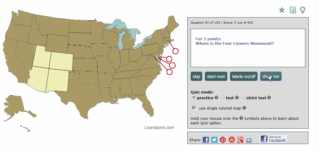
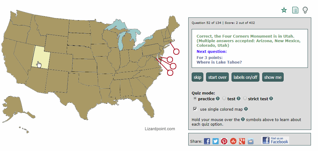
The tourism quizzes offer a feature we've never offered before - a destination can be in more than one place. So if we ask you where the Four Corners Monument is, Arizona, New Mexico, Colorado and Utah are all acceptable answers. And we'll show you that in 2 ways:
1. When you click on the "show me" button, all acceptable answers are highlighted, as the following screen capture shows:
2. When you click on a correct answer, the answer response lists all the acceptable answers, as shown in the following screen capture. The user answered with Utah, and the response from the quiz was, "Correct, the Four Corners Monument is in Utah. (Multiple answers accepted: Arizona, New Mexico, Colorado, Utah)"
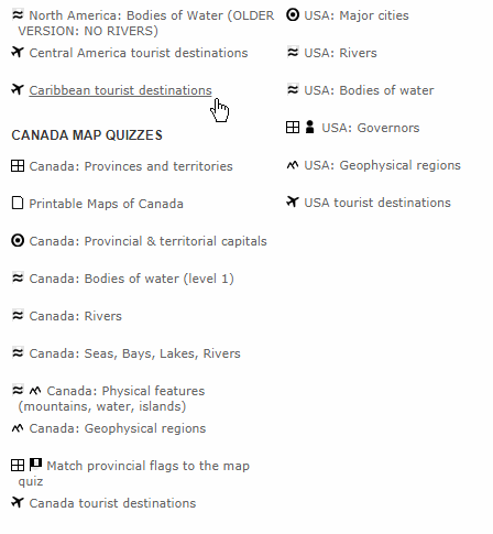
So far, we've created tourist quizzes for Africa, the Middle East, Canada, the USA, the Caribbean, Central America and South America. Quizzes for Europe, Asia and Australia/Oceania will be coming soon. Look for the airplane icon in the navigation to easily spot these new quizzes. You can see 4 tourist quizzes in this screenshot from the Americas navigation:
sample navigation with airplane icons indicating the tourist quizzes
The destinations asked in the quizzes were based on the learning needs of a particular tourism program at a Canadian college. But all the tourist quizzes are customizable, so that you can select from just the destinations you need. If you are an instructor of a Travel and Tourism program and you'd like some destinations added to the quizzes, please send us an email. Eventually, we hope to make it easy to add destinations yourself, but in order to satisfy an immediate need, we had to launch the quizzes with a fixed set of questions.
We realize that Travel and Tourism students need to know a lot more than just where the destinations are, but these quizzes will help with the "where", and free your mind up to learn the rest of the details you need to know for your program.
And now, for the example I mentioned earlier - here's a customization of the USA tourist quiz on mountains, caves and natural wonders. It's just a quick 11 question quiz but it serves as an example of how you can create a geography quiz that isn't necessarily tourism related.
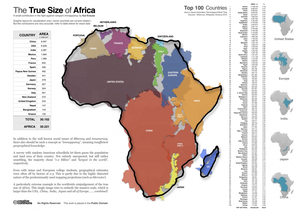
Another brilliant graphic that illustrates the true size of Africa (click on the map to see the full sized version).
This graphic very visually demonstrates that Africa alone is larger (in terms of area) than China, USA, India, Mexico, and much of Europe and South America. The power of this graphic and the surprise that it creates for readers, is based on the deep impressions made by the Mercator projection used in most maps that distorts the true size of many countries. This projection, published in 1569, was immediately useful because it depicts a line of constant bearing as a straight line, which is handy for marine navigation. The drawback is that it distorts the shapes and areas of large land masses, and the distortion gets progressively worse as you get closer to the poles.
Sigh... I thought I was doing all right with knowing about 65% of African countries... but little Max here seems to have me out-paced by some margin. The video was originally posted to the Tony Kroukamp YouTube Channel and shows 3-year-old Max rattling off names to countries while his father points them out on the map.
Now we just have to get Max onto Lizard Point and let him loose on the rest of the world. (Here`s a link to Lizard Point`s Africa quiz to test yourself against Max.... )