Nov 172015This year the National Geographic Society marks the 100th anniversary of their cartographic department. And Geography Awareness week seemed a good time to celebrate this milestone. The magazine's current issue features stories on some of the more interesting maps produced over the last century.
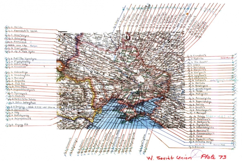
In reviewing it, you just can't help but be impressed with the breadth of maps and the unbelievable detail needed to render accurate, timely documents. One illustration shows some of the work necessary after the dissolution of the Soviet Union in 1991. This event necessitated changes to 90% of the place names in the Ukraine alone. I was certaintly struck by how manual this whole process looked. (At Lizard Point we are well aware of the detailed work involved in adjusting maps - but at least we do it all with programs and databases). In the case of the Ukraine, the illustration below shows printing and pointers overlaid on an analog map plate.
With a century of history to draw on, the National Geographic also has many rich memories. They feature the map that General Dwight D. Eisenhower carred across Germany during the Allied offensive in 1945. They also mention the story of Admiral Chester Nimitz landing lost in a rainstorm, utilizing the Society's map of the Pacific war theatre.
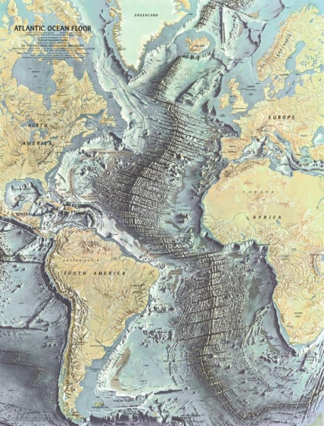
One featured map from 1968 really caught our attention. It charts the map of the floor of the Atlantic Ocean based on work of early geophysicists. Besides the beauty of the art work, what really stands out is the degree of detailed elevation in a part of the world that we are used to seeing as a uniform, flat, pale blue. This map brings home the reality of plate tectonics in a way that thousands of words could never convey.
The article closes with some words on the future of cartography with some tantalizing comments on the role of 'crowdsourced' cartography and the use of wearable technologies to increase the capture of geo-data. We can't wait.
Click here for the original article.
Nov 042015It is a bit of an axiom to state that geography dictates history. Leaders through time immemorial have played the cards that were dealt them in terms of their land's terrain, mountains, rivers and climate. In today's world, with technology essentially shrinking distance, we may be a little inclined to discount the true influence of geography on world matters. The recent Atlantic piece by Tim Marshall entitled, Russia and the Curse of Geography, does an excellent job of underlining its critical importance - notwithstanding technology.
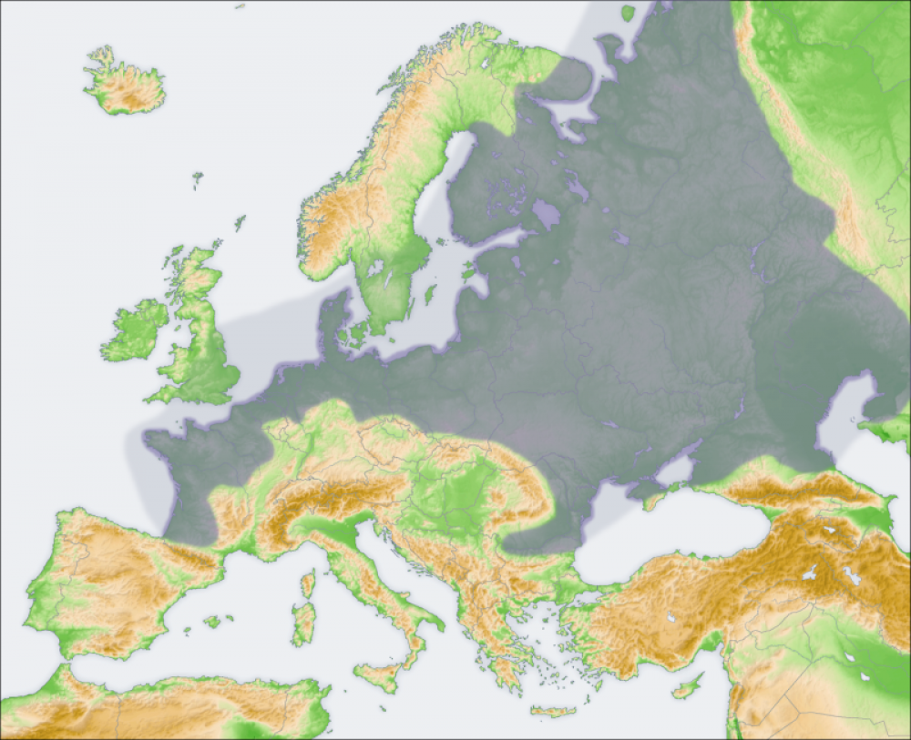
The European Plain, directly to Russia's west, has throughout history been a challenge for Russia. With no significant geographical barriers, this has been the path of many invaders into the motherland. The Poles came across the European Plain in 1605, followed by the Swedes in 1707, the French under Napoleon in 1812, and the Germans twice, in both world wars, in 1914 and 1941. The plains would also explain why Russia has repeatedly invaded Poland - occupying Poland allows for a defence of the plains at their narrowest point (300 miles).
The other key challenge to Russia is access to warm water ports. Without those, Russia is limited to the world's busiest sea-lanes only during warmer weather. Their northern ports are in the Arctic and their major port on the Pacific Ocean, Vladivostok, is enclosed by the Sea of Japan, and under largely Japanese control.
These two key strategic factors, Russia's vulnerability on land and its lack of access to warm-water ports, came together in Ukraine in 2014. When protests in Ukraine brought down the pro-Russia government and a new, more pro-Western government came to power, Putin did what Russian leaders have done for centuries. He chose his own kind of attack as defense, annexing Crimea to ensure Russia’s access to its only proper warm-water port, and moving to prevent NATO from creeping even closer to Russia’s border.
The article goes on to discuss similar rationale regarding Syria. Click the link for a fascinating read and reminder of the power of geography.
