
A century of map making - National Geographic
Nov 172015This year the National Geographic Society marks the 100th anniversary of their cartographic department. And Geography Awareness week seemed a good time to celebrate this milestone. The magazine's current issue features stories on some of the more interesting maps produced over the last century.
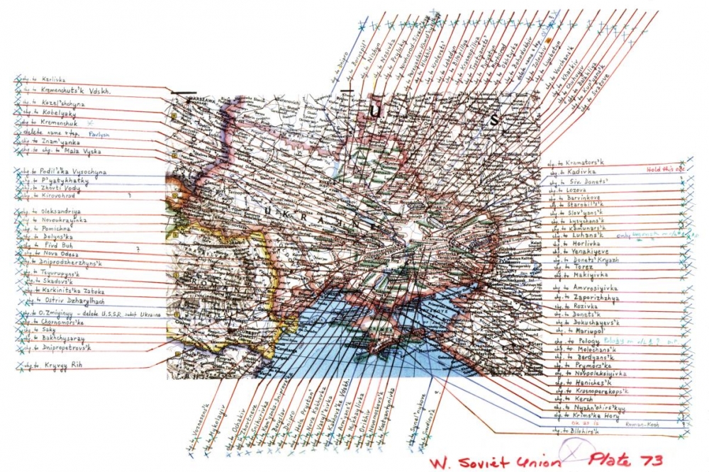
In reviewing it, you just can't help but be impressed with the breadth of maps and the unbelievable detail needed to render accurate, timely documents. One illustration shows some of the work necessary after the dissolution of the Soviet Union in 1991. This event necessitated changes to 90% of the place names in the Ukraine alone. I was certaintly struck by how manual this whole process looked. (At Lizard Point we are well aware of the detailed work involved in adjusting maps - but at least we do it all with programs and databases). In the case of the Ukraine, the illustration below shows printing and pointers overlaid on an analog map plate.
With a century of history to draw on, the National Geographic also has many rich memories. They feature the map that General Dwight D. Eisenhower carred across Germany during the Allied offensive in 1945. They also mention the story of Admiral Chester Nimitz landing lost in a rainstorm, utilizing the Society's map of the Pacific war theatre.
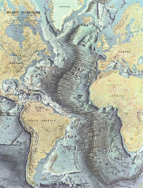
One featured map from 1968 really caught our attention. It charts the map of the floor of the Atlantic Ocean based on work of early geophysicists. Besides the beauty of the art work, what really stands out is the degree of detailed elevation in a part of the world that we are used to seeing as a uniform, flat, pale blue. This map brings home the reality of plate tectonics in a way that thousands of words could never convey.
The article closes with some words on the future of cartography with some tantalizing comments on the role of 'crowdsourced' cartography and the use of wearable technologies to increase the capture of geo-data. We can't wait.