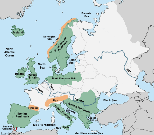
The
North European Plain's 
boundaries are approximate. It is part of a much larger plain know as the European Plain or Great European Plain, and stretches from the Pyrenees, up the west coast of France, along the northern part of Europe over to the Ural mountains.
The
Danube River passes through or touches the borders of 10 countries: Austria, Bulgaria, Croatia, Germany, Hungary, Moldova, Romania, Serbia, Slovakia and Ukraine.
Four European capitals are situated on the banks of the Danube:
- Budapest, Hungary
- Vienna, Austria
- Bratislava, Slovakia
- Belgrade, Serbia
The
Pyrenees is a mountain range in southwest Europe that forms a natural border between France and Spain. It separates the
Iberian Peninsula Iberian Peninsula from the rest of continental Europe.
The
Alps is a great mountain range in Europe that stretches 1,200 kilometres (750 mi) across 8 countries. The highest mountain in the Alps is Mont-Blanc, on the French-Italian border, at 4,810 m (15,781 ft) high.

 Loading questions...