
Blank maps to print and fill in
Jul 272018A frequently requested site feature is the availability of blank maps (and answer keys) for teachers and students to print and fill in manually. Not everyone learns the same way, so the printed blank maps will give you another way to practice your geography.
To start you off, we've added printable maps for the countries in Africa, Asia, Europe, and South America, as well as US states and Canadian provinces and territories.
There are 4 types of maps you can use:
- Blank outline map: A basic map with just the outlines of the countries (or regions/states/provinces). Students can write the names on the map.
- Labeled outline map: The basic outline map with the answers placed on the map. This map can be used to study from, or to check the answers on a completed outline map
- Numbered outline map: The basic outline map with every location numbered. Beside or below the map is an area to write the place names associated with each number.
- Numbered labeled outline map: The numbered outline map with the answers beside the numbers. This map can be used to study from, or to check the answers on a completed outline map.
Here's a sample numbered map of Africa with slots to fill in your answers. Click on the image to download and print the PDF file.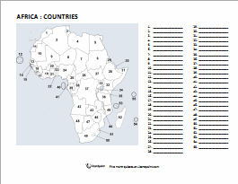
Please visit our printable maps page to access the rest of the blank maps.