Astana, the capital of Kazakhstan, was renamed earlier this month to Nur-Sultan, to honour former president Nursultan Nazarbayev, who had been president for nearly 29 years until he suddenly resigned. Nazarbayev was the first president of Kazakhstan - having been in the position since Kazakhstan declared independence in the dissolusion of the Soviet Union in 1991.
Acting president Kassym-Jomart Tokayev proposed the name change shortly after being sworn in, and it passed easily through parliament.
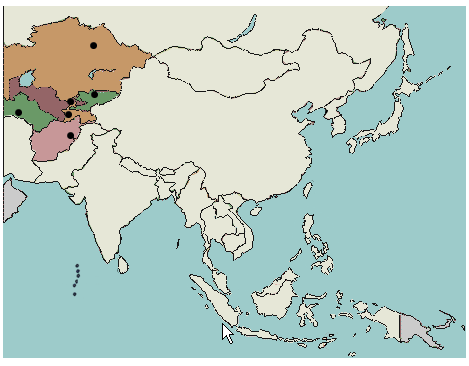
If you're a bit rusty on where Kazakhstan is, refresh your knowledge with this Central Asia countries quiz, and then move on to the Central Asia capital cities quiz. These quizzes are each just 5 questions long and are great for trying to keep the "stans" straight. A lot of people have trouble locating Kazakhstan, Kyrgyzstan, Ashgabat, Tajikistan,Turkmenistan and Uzbekistan.
Click on the map to try the Central Asia capital cities quiz:
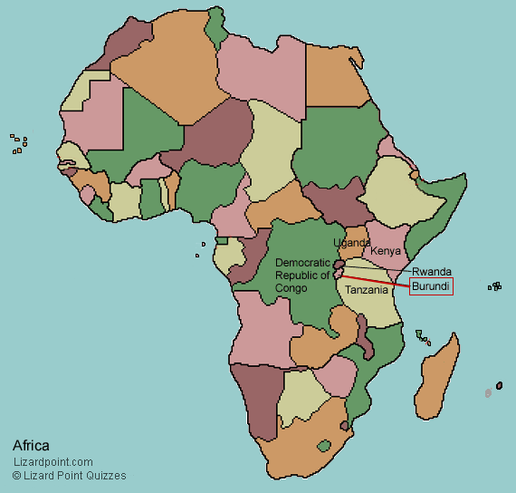
Burundi, a small nation in central east Africa, has declared a new capital city.
It was a promise made in March 2007, finally fulfilled. The Burundian government has officially declared the small town of Gitega to be its new capital city. The announcement was made over the Dec 22/23 2018 weekend, and Gitega became the capital on Dec 24.
How small is Gitega? The population of Bujumbura, the previous capital city (which will continue to be the country's economic centre), is approx. 331,700 (2018 figure). Gitega's population is 23,167 (2018 est.)
Location of Burundi in central east Africa is shown on this map:
For the next few months (maybe longer), the African capital cities quiz will ask you, "Where is Gitega (previously Bujumbura)?", so if you have memorized Bujumbura, you'll still be able to ace the quiz.
Territorial disputes are an inevitable aspect of political geography. One of the most contentious regions in the world is the South China Sea. We've been researching a blog for this on and off for a few months, but recently we found a succint videographic by The Economist that actually makes it understandable. The islands and atolls may seem insignificant at first blush - but not when you consider that they are located amidst potentially rich oil and gas sea reserves, in one of the business sea-trade routes in the world.
While everyone else this morning is reeling over the death of David Bowie, I'm far more shocked at the news that Canada has just been cut in half!
Living in a metropolitan area of over 6 million people, I often forget just how remote and isolated much of Canada is. And I never imagined that one bridge in the middle of Canada was the only thing joining the west with the east.
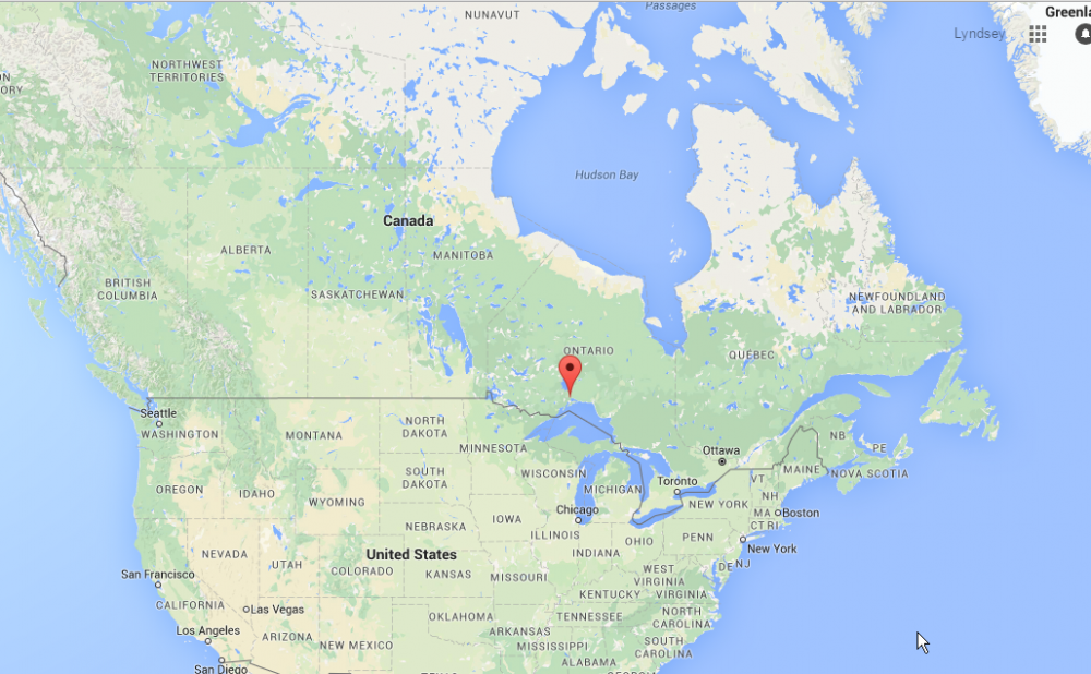
Due to extreme weather conditions, the Nipigon River Bridge has failed, causing one side of it to rise two feet. This bridge is on the Trans-Canada Highway, which you may gather from the name, is a highway that goes pretty much right across Canada.
“Canada has been cut in half,” said Nipigon Mayor Richard Harvey. “If you want to take something from Toronto to B.C., it goes across this bridge. There is no alternative. Every truck that goes across Canada goes across this bridge.” (Quote from the Toronto Star article on the bridge closure.)
Location of the bridge failure in Nipigon, Ontario. (Image credit: Google maps)
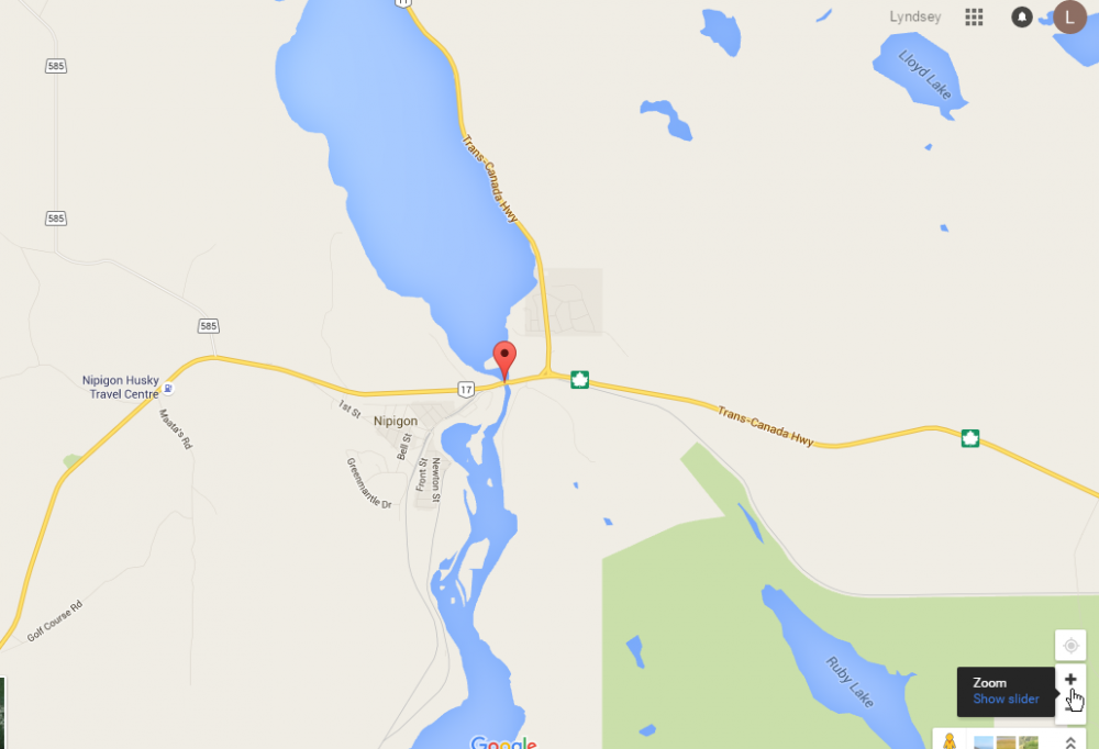
Zooming in, you can see the Trans-Canada Highway is pretty much the only road around. Other minor roads shown in grey just service local communities.
Detailed map of Nipigon River Bridge location, showing Trans-Canada Highway. (Image credit: Google maps)
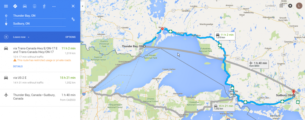
While the bridge is closed for who knows how long, all trans-Canada traffic must now take a detour through the US.
Gotta love Google, they're on top of things, already showing that the bridge is closed, and what the detour is. It looks like the additional travel time is 4.5 hours, plus however long the border crossings will take.
Detailed map of Nipigon River Bridge location, showing Trans-Canada Highway. (Image credit: Google maps)
This is a matter of national security, and will cause some serious economic impact, and I imagine will be the source of a lot of jokes. The perfect storm of Canada's renowned cold weather and remoteness.
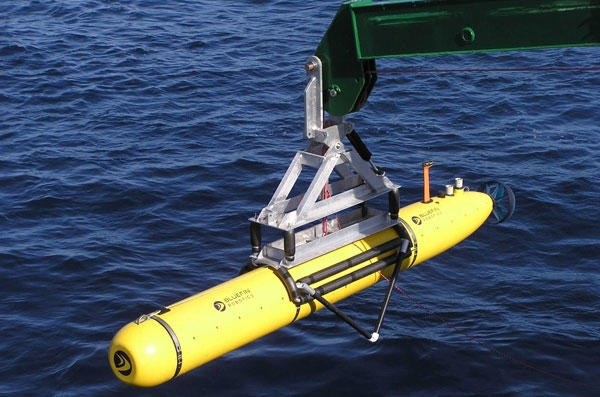
Drones are much in the news these days as prices fall and make the technology more and more accessible. Most of the interest is in the flying types of drones, but a recent GEOGRAPHICAL item discusses a different type of drone that has the potential to make new geographical knowledge available. As part of a growing interest in underwater drones, a start-up company called Hydroswarm is developing a robot to map the seafloor in greater detail.
Bluefin-21, the underwater drone of US navy sent to locate the debris of missing Malaysian plane MH370,
The EVE robot is a pumpkin-shaped bot is made for searching the sea. Made up of one part steering mechanism and one part ultrasound sensor, the autonomous drone could be more useful than existing remotely-operated robots as ‘they are less complex, but smart in terms of sensing,’ according to Sampriti Bhattacharyya, mechanical engineer at Massachusetts Institute of Technology and EVE’s creator.
Still in its development stage, the drone can only dive 250 metres below the surface. However, Bhattacharyya has ambitions towards using this kind of technology to create a deeper ‘Google Maps’ of the sea. ‘The whole point of Hydroswarm is to provide a cheap and scalable method of mapping the ocean,’ she says. ‘EVE can be used as a single drone, or as a bunch of them working together to map large areas.’ Deployed en masse, the drones use algorithms to communicate with each other in a network. Plus, they don’t get lost. ‘They have a homing mechanism and are recovered at the end of their missions,’ she says.
Beyond Hydroswarm - hobbyists can examine other startups with their own versions of underwater drones. Fathom and OpenROV both have interesting technologies and approaches.
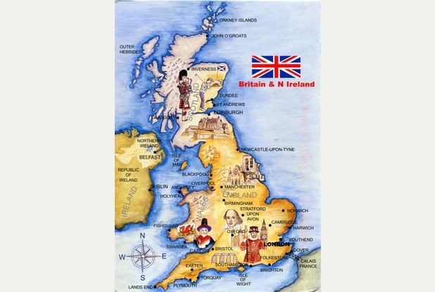
We think our American friends take a lot of teasing in the press every now and then when a survey comes out revealing gaps in geography knowledge. So we thought it only fair to report on a story out of Northampton in the UK.
The recent Travelodge survey reveals some shocking facts:
about 1 in 10 (11%) believe the UK is made up of more than 6 countries,
Almost the same (9%) believe that England alone makes up the UK,
Over half (54%) think that the UK has a bigger island than Great Britain,
In fact, over one third didn't know the difference between the UK and Great Britain, and
None of the respondents knew how many islands surround the mainland.
Well, to be honest, the answer to that last one (over 6,000) surprised us. However, look for that question to be in an upcoming Trivia quiz. But we do expect all our viewers to get perfect on this quiz.
Now, if you really want to to understand the British Isles a little better, we heartedly recommend the following video (watch until about 2:15 = although the rest is interesting too).